At 9:43 on June 23, 2020, the 55th Beidou navigation satellite, which is the last networking satellite of the Beidou III system, was launched from Xichang Satellite Launch Center. The global satellite navigation service will usher in the Era of Beidou.
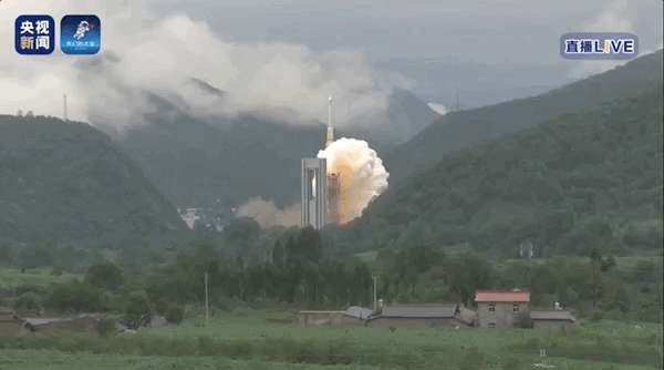
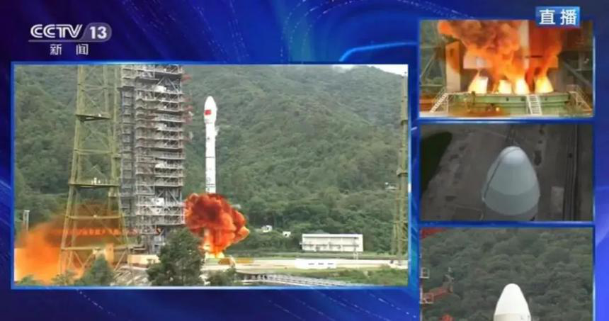
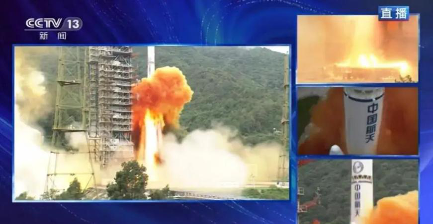
"We have come a long way in 26 years," Liu Jingnan, 77, a Wuhan-based expert on geodesy and satellite navigation, who is also a member of the Chinese Academy of Engineering, and the former president of Wuhan University, said. He had been watching the launch live and was very excited and proud. In a relatively short period of time, Beidou went from first catching up on existing advanced satellite technologies, to surpassing that same technology’s leaders, which embodies the spirit of Chinese scientific and technological workers in overcoming difficulties and pursuing excellence.

Liu Jinnan in an interview
Yang Changfeng, chief designer of the Beidou satellite navigation system, once said that for the system to become autonomous and controllable, it must achieve 100 percent localization.
Beidou I
In 1994, the Beidou I project was officially approved, and China embarked on the journey of developing satellite navigation technology on its homeground. Starting from a solar panel of the Beidou I, China has gradually mastered the key technology and realized localization of core components under the blockade of key technologies abroad.
Beidou II
Starting with the rubidium atomic clock, the "heart" of the whole navigation satellite, the domestic rubidium clock was developed from scratch. Under the efforts of experts from the Wuhan Institute of Physics and Mathematics, Chinese Academy of Sciences, with Beidou II all navigation satellites were equipped with the domestically-made rubidium clock.
Beidou III
By the time Beidou III entered the stage, all components and core devices had been localized. The Beidou Satellite Navigation and Positioning System has won first place in the world in terms of the number of satellites, patent application and networking speed, making it the first echelon in the field of international satellite navigation.
Let Beidou fly into the sky first
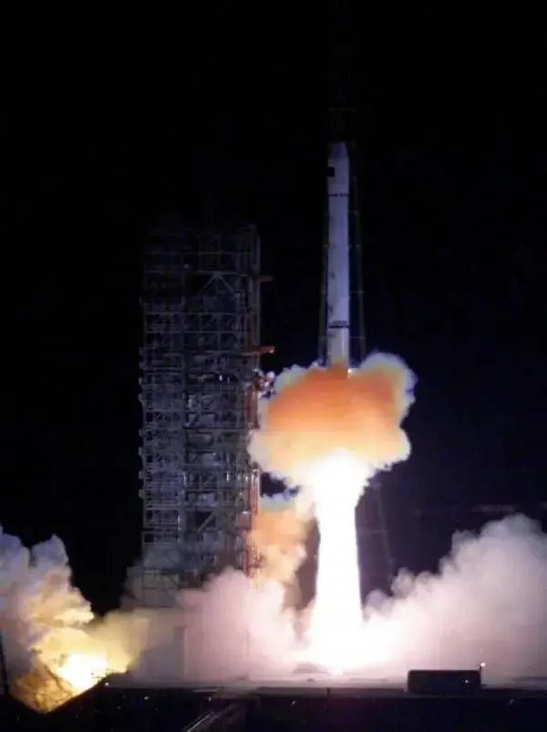
In the early morning of October 31, 2000, the Beidou Navigation Testing Satellite, China's first self-developed navigation and positioning satellite, was launched into space
In 1973, the United States began to develop a 24-satellite GPS navigation system, which was publicly accessible to the world in the 1990s. The prototype of China’s self-developed Beidou navigation system was born in the early 1980s.
Later, Chinese scientists named the country’s self-developed navigation system project "Beidou I", which symbolizes the North Stars in the sky.
Liu Jingnan, who participated in the R&D of the first generation of Beidou, has been called "the pioneer of GPS applications in China". In 1997, Hong Kong returned to China, and following many disputes between Chinese and British demarcation experts, the demarcation line between Shenzhen and Hong Kong was agreed. The coordinates of the Shenzhen GPS framework network implemented by Liu Jingnan were adopted as the basis for demarcation.
When it came time to developing China’s own positioning system, Liu Jingnan was invited to join the national team. He proposed the technology of distributed wide-area differential system, established China's independent wide-area and high-precision satellite navigation technology, and realized the real-time positioning accuracy in centimeter-level through the National BDS Augmentation System.
Liu Jingnan revealed that more than 10 years ago, when the Beidou II plan was put on the agenda, there was some debate among the experts. One proposal was to build a global navigation satellite system in one step, and the other was to build a regional navigation satellite system and then gradually build a global navigation satellite system in two steps. "Time went by as we kept arguing. I advocated doing it first, which is more in line with China's national conditions," Liu said.
Finally, the Beidou satellite navigation system adopted the "three-step" strategy: the first step was to build the Beidou first-generation testing system in 2000 to establish the country’s satellite navigation system from scratch; the second step was to form a service capacity covering the Asia-Pacific region by 2012; the third step was to build a global service capacity by 2020.
Let Beidou be put into practice
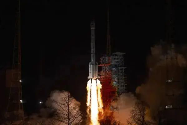
At 19:55 on March 9, 2020, China successfully launched the 54th Beidou navigation satellite.
Mengxin Technology Company, based in Wuhan, is in the first echelon of Beidou chip R&D.
In 2014, Han Shaowei, a Beidou chip R&D scientist, founded Mengxin Technology Company in Wuhan and served as the general manager of Wuhan Navigation &LBS. He led the team to develop China's first 40-nanometer high-precision Beidou navigation and positioning chip for consumption use in Optics Valley. This self-developed chip achieved nearly 10 million calculation and memory units on a 1/5 dime-sized silicon body, and on the basis of this chip, modules, boards and receivers were gradually formed, filling gaps domestically.
Within six years, the Beidou chip made by Mengxin Technology has been upgraded to the second generation, and the third and fourth generation of products are being planned. Equipped with the "China Chip", the UAV can realize centimeter-level spacing sowing in the farmland, and finish the seeding for 1 mu in less than 5 minutes. When installed on the power equipment, it can achieve time synchronization with nanosecond-level accuracy
At the same time, Liu Jingnan’s team from Wuhan University is researching and developing the next generation of high-precision Beidou positioning and navigation timing chips. The construction of the "ground-based enhancement system" undertaken by his team has continuously improved the "vision" of Beidou. Through the foundation enhancement and space-based enhancement, the time accuracy can be 1 nanosecond or even better, the real-time position can be accurate to 1 centimeter, and the precision in specific fields can be 1 millimeter.
"We will make Beidou accessible to Chinese people through mobile phones, cars and terminals." With the advent of the commercial 5G era, Beidou will be integrated with new technologies such as new-generation communication, blockchain and artificial intelligence, and new models, new patterns of business and new economy will emerge continuously,” said Yu Feng, the vice president of Wuhan Navigation Academy.
During the fight against COVID-19 in Wuhan, the Beidou Satellite Navigation and Positioning System was used in the construction of Wuhan Huoshenshan and Leishenshan hospitals. Liu Jingnan said that in view of the epidemic, he and his colleagues are building a command system for emergency epidemic prevention based on the Beidou Internet of vehicles. They are studying how to use the combination of Beidou communication system and positioning system to establish a multi-level, cross-regional and cross-departmental joint command and dispatching system under the unified control of vehicles, personnel and materials in combination with 5G and 4G communication networks of mobile phones.
Let Beidou “go global”
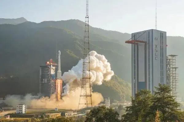
On November 23, 2019, China successfully launched two Beidou III global networking satellites
After the emergence of Beidou’s "Spoiler", the market share of GPS shrank from more than 95% to 75% in the domestic market.
After forming a global network, Beidou can now serve the whole world. But before that, China had no say in standards. There are many organizations in the world that develop technical standards for the receiving equipment of global satellite navigation systems in the world, but few Chinese enterprises and institutions are involved.
The Beidou experts, led by Han Shaowei, helped make Beidou the third international standard system for maritime services in the world, giving Beidou a pass to “go global”.
"Orders in the first half of this year increased a lot in year-on-year terms," According to Fang Ting, the general manager assistant of Mengxin Technology. Recently, three new products of Mengxin were launched in succession, fully supporting the Beidou III system to achieve great international competitiveness.
By the end of 2019, the shipment volume of domestically-made Beidou navigation chip modules had exceeded 100 million, and Beidou navigation chips, modules, high-precision board cards and antennas had been exported to more than 100 countries and regions.
"Now many mobile phones at home and abroad can receive the Beidou navigation signals," Liu Jingnan said. “Within one year or two, people will be able to use the high-precision Beidou navigation signals on their mobile phones. Users around the world can enjoy various high-precision space and time location services provided by China's Beidou Navigation Satellite System”.
At present, Wuhan is at the forefront of navigation technology in China, and has formed a whole industrial chain from design, to packaging and inspection. Alone in the East Lake High-Tech Development Zone, there are nearly 30 units engaging in research and development, design, manufacturing, and application services of Beidou navigation technology.
In addition to the Mengxin Technology and Wuhan Navigation & LBS in the upstream, there are also high-tech enterprises such as GeoStar and Zhondi Cyber in data processing and operation support fields of the midstream. Among the application services in the downstream, are Zoyon, which is engaged in the development of intelligent vehicles, Kotei, which provides automobile navigation services and so on. Beidou Group in Wuhan has shown China's precision to the world, and the industrial scale will be further improved.
Written by: Yang Jiafeng, Li Jia
Rewritten by: Chen Muying
Edited by: Wu Buer


