On February 15, the United Nations Satellite Center (UNOSAT) released on its official website a report by Li Xi’s team at Wuhan University (WHU) on the assessment of the Turkey-Syria earthquakes using luminous remote sensing. The report was completed by WHU in cooperation with UNOSAT and was also published through the Global Disaster Alert and Coordination System jointly operated by the European Commission and the United Nations.
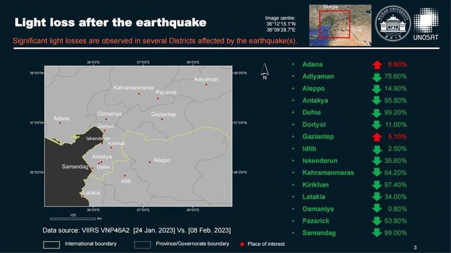
The report uses luminous remote sensing technology to evaluate the extent of damage caused by the earthquakes to urban electricity in terms of the area scale and the city. Through the continuous observation of data from the NPP satellite of the United States, it was found that as of February 9, the earthquake had caused a large number of cities in the earthquake region to have power outages, concentrated in the plate boundary between Kahramanmaras and Antakya. In a sign of the scale of the damage, Defne and Samandag, the worst-hit areas, reported losses of 99%, while Kirikhan and Antakya lost more than 95%.

Electricity loss assessment of the earthquake region on February 9
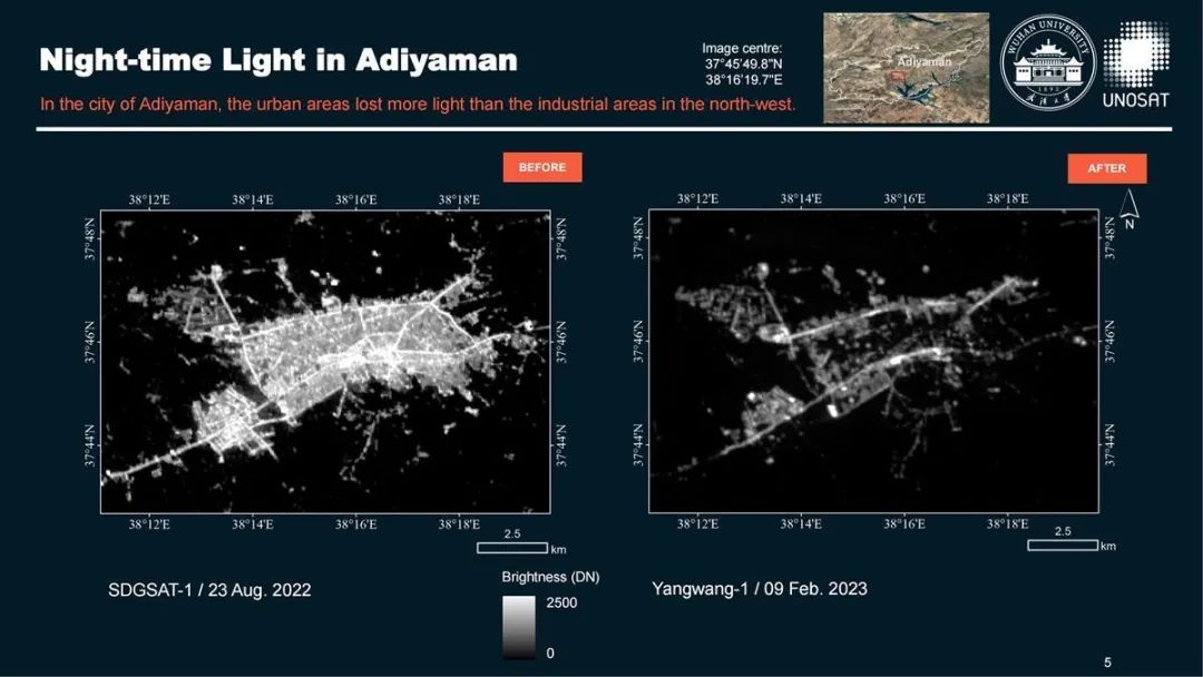
Li Xi’s team further conducted a key observation of Adıyaman and Antakya through a domestic high-resolution luminous remote sensing satellite and found that the power losses were significantly higher in eastern Adıyaman than in its west, relatively light in the northwest industrial area of Adıyaman, and greater in Antakya’s urban area than its suburbs. “By comparing the luminous remote sensing images taken before and after the earthquake, we can clearly see that the light in the Adıyaman industrial area was less affected, which may be related to its stronger power system and buildings. Combined with field investigation and analysis of specific reasons, it can provide a reference for future seismic design of power systems,” said Li Xi.

After the earthquake, the brightness of the eastern Adıyaman drops more than that of the west, which reflects a more significant electricity loss in the east.
Due to the long-standing close partnership between WHU and UNOSAT, WHU was invited to participate in the emergency mapping service for the Turkey-Syria earthquakes from February 6. Li Xi, a professor at the State Key Laboratory of Information Engineering in Surveying, Mapping, and Remote Sensing at Wuhan University and doctoral supervisor, was mainly responsible for the mission. His three graduate students, Gong Yu, Cao Hanrui, and Jia Minghui, also joined the emergency action team. The report from WHU is the first and the only remote sensing analysis of earthquake regions published on the website of the UNOSAT so far.

Cover page of the assessment report
“Though daytime images are intuitive, they merely reflect partial situations,” Li said. “Our luminous image analysis data is more macro and integrated with humanitarian concerns. It is thus a good complement to the daytime remote sensing assessment.” He also shared three main points regarding the significance of this urgent mission: real-time assessment of the disaster situation is conducted, and data support can be provided for decision-making on relief operations, humanitarian assistance and post-earthquake reconstruction; important reference value for future disaster prevention and mitigation work is provided; it is also proved that luminous remote sensing can quickly and macroscopically assess disasters so that the United Nations and governments can recognize the importance of this technology and make certain technical reserves for coping with possible disasters in the future.

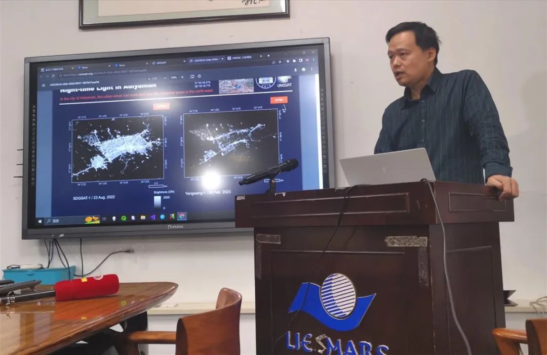
Li Xi explaining the luminous remote sensing analysis
At present, the rescue operation of the Turkey-Syria earthquake is basically complete, and the next focus of the international community and the local government will be post-earthquake reconstruction, to which Li Xi’s team will contribute luminous remote sensing and multi-source data assessment. Scholars and students of WHU have again shouldered responsibilities in global affairs, presenting and stimulating more streams of strength converging into the river called ‘the world’.
Rewritten by Li Jing
Edited by Wu Jing, Sylvia, Xi Bingqing