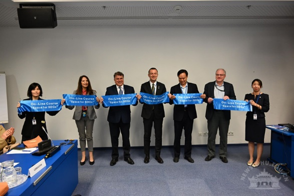
An online course, "Earth Observation for Sustainable Development: Harnessing the Power of Chinese Satellites", led by Wuhan University (WHU), was unveiled at the 69th session of the United Nations Committee on the Peaceful Uses of Outer Space (COPUOS), which commenced on June 10 in Vienna, Austria.
The launch ceremony was graced by prominent figures including Aarti Holla-Maini, director of the United Nations Office for Outer Space Affairs (UNOOSA); Jiang Hui, secretary-general of the Asia-Pacific Space Cooperation Organization (APSCO); and Li Xi from WHU’s State Key Laboratory of Information Engineering in Surveying, Mapping, and Remote Sensing.
Li emphasized the collaborative effort of over 10 Chinese remote sensing scientists in developing the course, highlighting its role in showcasing the advancements and applications of Chinese satellite remote sensing technology.
He added that this initiative embodies the commitment to fostering a shared future for the global community and has been praised for its potential to advance the United Nations' 2030 Sustainable Development Goals.
The course is structured into five sessions, integrating practical application cases to introduce high-resolution radar satellites, Fengyun meteorological satellites, ocean satellites, high-resolution optical satellites, and WHU's Luojia series satellites.
The course can be accessed by registering with the United Nations University Learning Center and searching for it by name.
This initiative has garnered support from the UN-SPIDER Regional Support Office in China, which has played a crucial role in coordinating WHU's remote sensing resources to provide satellite-based emergency assessments and responses for several major global natural disasters.
 中文
中文