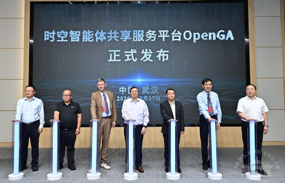
Wuhan University (WHU) released the Open Geospatial Agent (OpenGA) V1.0, a spatiotemporal intelligent sharing platform, on Oct 17, coinciding with the 70th anniversary of the university’s surveying and mapping discipline.
OpenGA, structured around "one engine, one platform, one set of standards, and three libraries”, was developed by Professor Gong Jianya, an academician of WHU's Chinese Academy of Sciences. It is built on the China-based Digital Earth Engine, OGE (Open Geoscience Engine), and uses the unified GeoMCP protocol and GeoSkill standards to ensure compatibility with international spatiotemporal information standards.
This framework enables interoperability of tools, models, skills, and agents, laying the foundation for "spatiotemporal intelligent infrastructure" that can be integrated into smart city, natural resource, and energy business systems.
OpenGA enables unified access to and sharing of external models and agents, addressing the limitations of single large models and agents in solving all spatiotemporal issues.
It integrates WHU's self-developed hydrological, multi-modal remote sensing, and change-detection large models, and supports integrating GIS remote sensing operators and tools from various providers, shifting from individual to collaborative intelligence.
The platform has seen applications across natural resources, ecological environments, energy transport safety, and the low-altitude economy, offering capabilities such as ecological monitoring, disaster warning, and UAV inspection.
 中文